Agricultural Drone Photography in Norfolk: What a Sub 250g Drone Can Do on a Working Farm
Norfolk is farming country and always has been.
Arable ground across the Fens and the Broadland levels, sugar beet heading for Cantley and Wissington, poultry and pig units tucked away down single track lanes, and a good number of holdings that now earn money from something other than the crop.
Most of it is invisible from the road, and a fair bit of it is invisible from the gate as well.
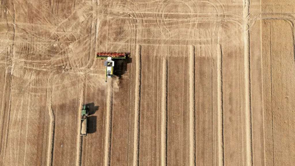
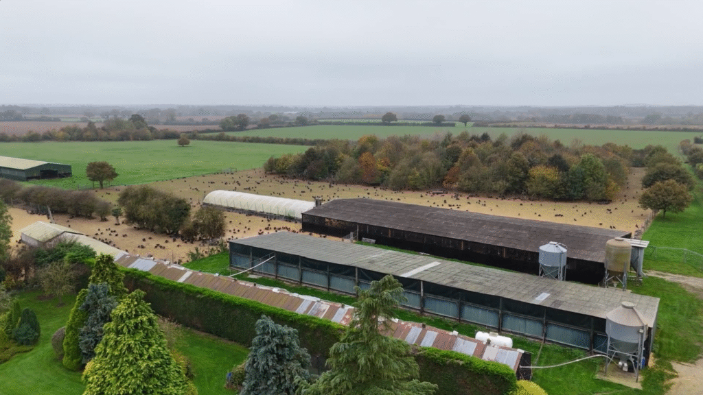
A field looks completely different from a hundred feet up. Our Agricultural drone photography in Norfolk puts the whole holding in one frame: the drainage, the crop, the boundaries, the tracks and the yard, all at once, in a way you simply cannot see from the cab.
For farms, estates and rural businesses in Norfolk, that view earns its keep well beyond a nice picture on the wall.
Here is what I do with it, what I do not do with it, and how the work fits around a farm that is trying to get on with its day.

First, the honest bit about what this is
There is a whole industry built around agricultural drones and a lot of it is genuinely clever.
Multispectral and NDVI crop health mapping, yield and prescription maps feeding straight into the sprayer, survey grade photogrammetry, volumetrics on a grain heap, spray drones.
That work needs specialist sensors, specialist aircraft and an agronomist or surveyor at the other end of it. I do not offer it and I am not going to pretend otherwise.
What I offer is professional aerial Agricultural Photography and Agricultural video, (But actually, not just related to drones. We’ve got a whole portfolio related to Agricultural video productions… You can find that right HERE)
Properly composed, properly exposed, properly graded imagery of your land, your buildings and your business, shot to a commercial standard and delivered ready to use.
If what you need is a prescription map, you want an agronomy provider. If what you need is to actually see your holding, show it to somebody, sell something off the back of it or keep a record of how it changed, that is my end of the job.
Being clear about that up front saves everybody a wasted phone call.
What agricultural drone photography shows you
A clear view from above is useful in a very ordinary, practical way:
- The whole holding in context, with fields, tracks, yards and buildings in one shot
- Standing water and drainage problems that are obvious from the air and easy to miss from ground level
- Crop variation across a field, the patchy corners and the strong ground
- Boundaries, fencing, gateways and access routes
- The condition of tracks, hardstanding, roofs and farm infrastructure
- Headland and margin layouts, and how they actually sit against the field
None of that is data wizardry. It is what you can see when you get above it, captured properly so you can study it afterwards, keep it on file, hand it to an agent or a contractor, or put it in front of somebody who needs to understand the place without driving three hundred miles to stand in it.
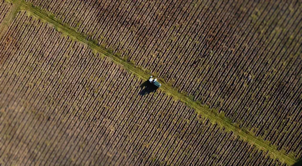
Marketing the farm, the estate and the diversification through agricultural drone photography
Plenty of Norfolk businesses now sell something beyond the field gate.
A farm shop, holiday cottages, a wedding barn, glamping, a campsite, storage, an events field, or the land itself when it goes to market.
Agricultural drone photography makes all of that look the part.
A sweeping shot across the estate, a tidy overhead of the yard, a short film that gives a real sense of setting and scale: this is what lifts a website, a brochure or a land agent’s particulars above the usual phone snap taken from the corner of the car park.
If you have put serious money into a rural enterprise, it deserves to be shown properly, and the aerial angle is the one nobody else has.
It works just as hard for machinery dealers, contractors, grain stores, feed businesses and rural construction.
Anything large enough that ground level photography cannot take it all in.
A record that builds across the season
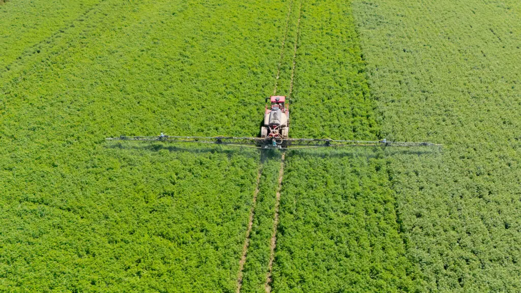

Land changes through the year and a drone is a straightforward way to keep track of it.
Agricultural drone photography before and after a drainage scheme. A new shed going up from slab to cladding. The same block of ground in April and again in August. Over a couple of seasons you end up with a genuine visual record of the holding.
That is useful for your own planning, useful for grant and scheme paperwork, useful when there is a dispute about a boundary or a track, and useful as a marketing library you can draw on whenever you need something.
Repeat agricultural drone photography visits to the same site are quick and cheap once the risk assessment and airspace work is already done.
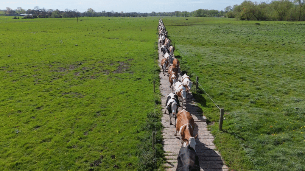
Harvesting those great crops and showcasing your livestock on the pastures and in fields.
Agricultural drone photography can help grow your business. Aerial imagery of your animals that reflect the best husbandry and provenance has more credence than you can ever imagine.
It could be a free roaming venison heard on Gunton Estate, Great Grove Turkeys shown in their enormous free-range surrounding or a heard of cattle coming in at the end of the day for milking.
We’ve captured all of these and for aa business trying to develop more of a market presence, video and imagery has never played such an important role.
Why I fly a sub 250g drone on farms
This is the part that matters more than it sounds. A working farm is not an empty film set. There is stock, there are staff, there are contractors, there is a combine that will not be stopping for anybody, and there is a yard full of things that do not need a large aircraft buzzing over them.
I fly a sub 250g aircraft, and on agricultural work that is a deliberate choice rather than a compromise:
- It is quiet and small. Around stock and around a busy yard it barely registers. That matters near livestock, and it matters when your staff are trying to work.
- It sits in the CAA’s A1 subcategory. Since January 2026, sub 250g is the only weight that keeps full A1 privileges, which means I can work close to buildings, plant and people without the standoff distances a heavier aircraft has to keep. On a tight yard or around a barn conversion, that is the difference between getting the shot and not getting it.
- It goes up fast. No rigging, no crew standing about. If the light comes good for twenty minutes over harvest, we are in the air and using it.
- It is low impact if anything goes wrong. Less energy, less aircraft, less risk to anything underneath it.
The trade off is honest enough: it is not a survey platform and it does not carry a specialist sensor.
For the imagery I am there to produce, that has never been the limitation people expect it to be. The result on the screen is what counts, and a small aircraft in the right position at the right time beats a big one in the wrong place every single time.
I keep a sensible distance from stock, I work around your day and the farming calendar rather than mine, and I get permissions squared away before I arrive.
The aim is that the flight comes and goes without anybody, two legged or four legged, being bothered by it.

Rural Norfolk airspace is not empty
Worth knowing, because it catches people out. Rural does not mean unregulated, and Norfolk is a long way from being quiet airspace. Agricultural drone photography needs preparation and compliance. It;s not ok to simply take- off because the surrounding space looks empty.
There is a Flight Restriction Zone around Norwich Airport.
There is military activity around Marham and across the border at Lakenheath and Mildenhall, and low flying training that you genuinely have to look and listen for.
There are gliding and microlight sites, and a scattering of active grass strips and former wartime airfields that are still in use.
Add air ambulance and police activity on top and a field in the middle of nowhere can still sit under airspace that matters.
That is why I check the airspace for every job, not just the ones near a town, and why the answer is occasionally that we fly on a different day or from a different corner of the farm.
The professional bit, on your land

Aerial work on a commercial holding is a commercial operation and I treat it like one. CAA registered with a current Operator ID and Flyer ID, £10m public liability drone insurance, and a written site specific risk assessment produced before the day rather than scribbled on the bonnet when I arrive.
If your insurer, your landlord or the estate office wants to see the paperwork, it exists and it goes over in advance.
The official guidance sits on the CAA’s drones pages if you want to read the rules yourself.
Working across Norfolk

I am based in Norwich and cover Norfolk properly: Broadland and the Broads, Breckland and Thetford, mid Norfolk, the north Norfolk coast, the Fens and west Norfolk, south Norfolk and over the border into Suffolk.
Most of the county is inside an hour, which keeps travel off the invoice and makes repeat seasonal visits realistic.
If you have a holding, an estate or a rural business in Norfolk and you want to see it properly, get in touch and tell me what you are trying to achieve with the pictures.
I will tell you honestly whether aerial work is the right tool for it, and what it will cost, before you commit to anything.
Blanc Creative, Norwich. studio@blanc-creative.com or 07871 364041.